Table of Contents
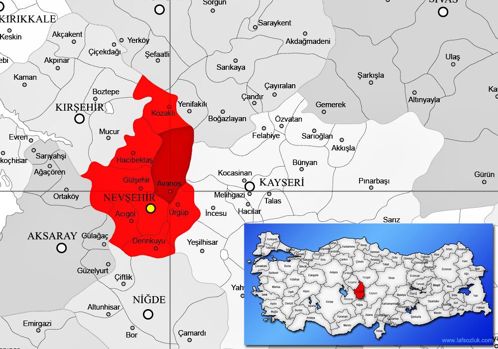
Cappadocia Map; Although Cappadocia is connected to Nevsehir in terms of location, it is spread over a wide region including the provinces of Kayseri, Nigde, Kırşehir and Aksaray. Cappadocia, one of the most important tourism centers in Turkey, is among the most visited destinations in Turkey. Cappadocia is known by many as a city. But this is wrong. Cappadocia is the name given to a region, not a city. Although Cappadocia is identified with the province of Nevsehir, it also includes some cities neighboring Nevsehir. But if you want to come to Cappadocia, you need to consider Nevsehir as your destination.
You may be interested: Where is Cappadocia?
Cappadocia Map; Nevsehir province is located at the junction where the Aksaray – Kayseri road is followed and the Niğde – Kırşehir road joins. Nevsehir is 276 km from Ankara and 729 km from Istanbul. The distance of Nevsehir province to other provinces included in the Cappadocia region is as follows:
- Nevsehir – Kırşehir: 91 km
- Nevsehir – Kayseri: 81 km
- Nevsehir – Niğde: 82 km
- Nevsehir – Aksaray: 75 km
Where Is Cappadocia In Turkey Map?
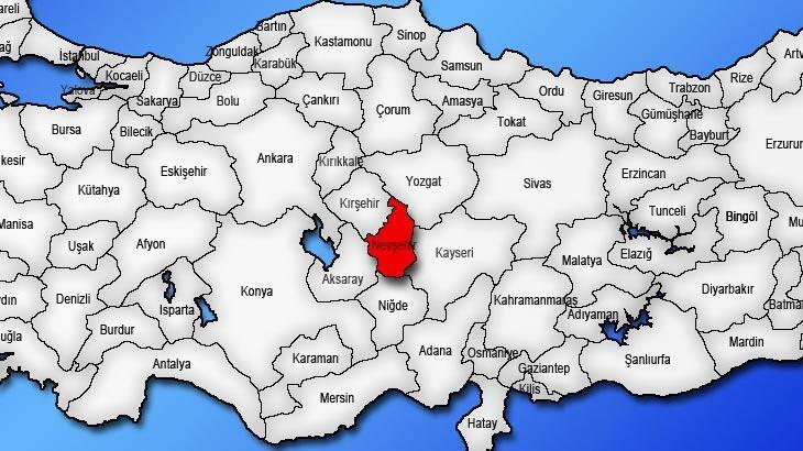
Cappadocia Map; Cappadocia is located in the middle of Anatolia and Turkey, in the region that includes some parts of the provinces of Kırşehir, Niğde, Aksaray and Kayseri, with Nevsehir in the center. Many civilizations have ruled in the Cappadocia region throughout history. Primarily Hittites, Phrygians, Assyrians, Persians, Byzantines and Romans, Seljuks and Ottomans left many historical monuments in these lands. Today, when you say ‘Cappadocia’, the first place that comes to mind is Nevsehir, which is located right in the middle of the region.
How Far Is Cappadocia From Istanbul?
Cappadocia Map; The distance between Istanbul and Cappadocia is approximately 760 km on the highway. The journey by car between Istanbul and Cappadocia takes approximately 8 hours. If you plan to come by bus between cities, this time can be up to 11 hours. If you prefer to travel between Istanbul and Cappadocia by plane, the flight time takes approximately 1 hour and 10 minutes.
Cappadocia is known by many as a city. But this is wrong. Cappadocia is the name given to a region, not a city. Although Cappadocia is connected to Nevsehir in terms of location, it is spread over a wide region including the provinces of Kayseri, Nigde, Kırşehir and Aksaray.
Cappadocia Guide
Which Airport Is Closest To Cappadocia?
Cappadocia Map; The two closest airports to the region are the Cappadocia Airport in Nevsehir and the airports in Kayseri. However, Nevsehir Airport is generally preferred because it is closer to the Cappadocia region. The frequency of the expeditions varies according to the city and periods. You can reach Cappadocia from Nevsehir Airport by taxi, private transfer or the shuttle service of the hotel you will be staying at.
Cappadocia Map
Cappadocia Map; A large part of Cappadocia is located within the borders of Nevsehir province, within the triangle of Urgüp, Goreme and Avanos. This is the most popular and most visited region of Cappadocia.
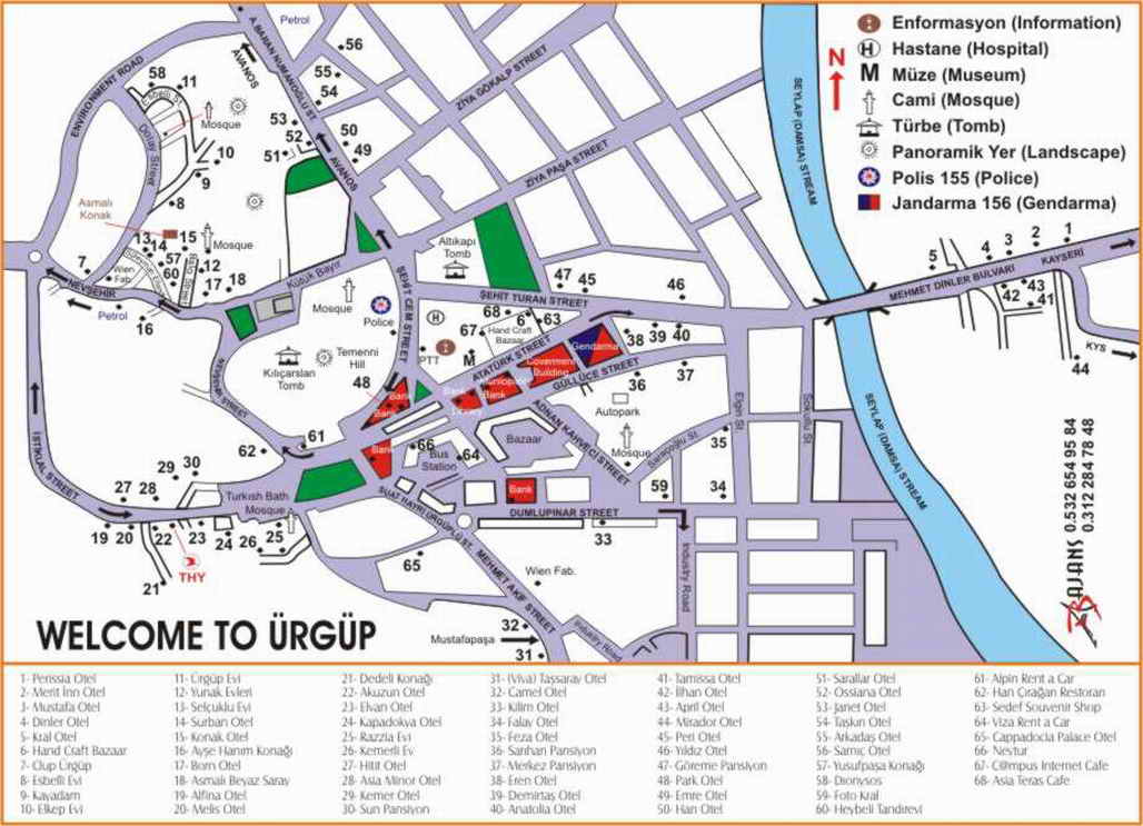
Urgup Map
Urgup, 20 km east of Nevsehir, is one of the most important centers of the Cappadocia Region. As in Goreme, it has had many names in the historical process. It was called Osiana (Assiana) and Hagios Prokopios in the Byzantine Period, Başhisar in the Seljuk Period, Burgut Castle in the Ottoman Period, and Urgup since the first years of the Republic. Urgup has many places to see, especially the Pink Valley and the Red Pit.
Goreme Map
The town of Goreme, 10 km from Nevsehir, is located in the region surrounded by valleys between the Nevsehir-Urgup-Avanos triangle. The Cappadocia region, bordered by Kızılırmak in the north, Yeşilhisar in the east, Hasan and Melendiz Mountains in the south, Aksaray in the west and Kırşehir in the northwest, has been a permanent settlement since the Chalcolithic Period.
The most important feature of this region, which was inhabited during the Hittites, Assyrian, Kalonies, Phrygian, Tabal, Med, Pars, Iskender Sultanate, Seleucid, Byzantine, Seljuk, Karamanli and Ottoman periods; The extraordinary rock formations of the Erciyes Mountain and Hasan Mountain tuffs, formed as a result of wind and water erosion, are rock-carved places that are warm in winter, cool in summer and therefore have suitable internal climate conditions for all seasons.
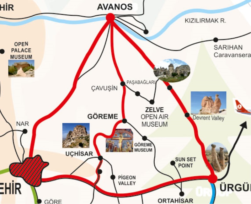
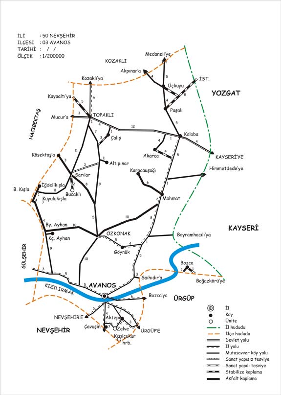
Avanos Map
The ancient name of Avanos, which is 18 km north of Nevsehir, was Venessa. The tradition of making ceramics in the district, which has many pottery workshops, has been going on since the Hittites. The red soil brought by Kızılırmak and the ceramic clay obtained from the shaft are shaped in the hands of ceramic artists from Avanos. Food pots, water jugs, pots and jars for winter food storage, water bottles are well-known bowl products in the region. Avanos is now known as “Cappadocia’s Handicrafts and Shopping Center”.